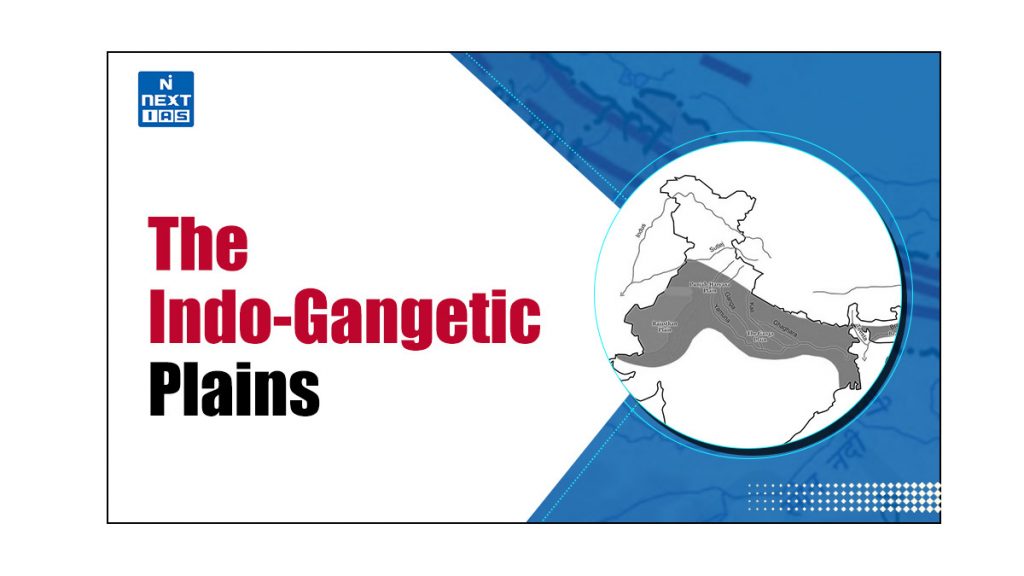
The Indo-Gangetic Plains covers around 7,00,000 sq. kms, a highly fertile and populated region situated in the northern part of India. The region is formed by the Alluvial deposits of River Indus, Ganga, Brahmaputra and supports about one-seventh of the world population. Indo-Gangetic Plains are surrounded by the Himalayas in the north and the Deccan in the south.
The Indo-Gangetic Plains are divided into 4 geological regions: Bhabar, Terai, Bhangar, Khadar.
- The Bhabhar is a narrow strip at mountain foot having coarse gravel and pebbles. This region is highly porous and the rivers completely disappear underground.
- The Terai region lies just south of bhabhar and the disappeared river streams gets re-appeared in this region supporting the dense vegetation.
- The Bhangar has older and higher alluvial plains and contains calcium carbonate nodules which is locally known as kankar.
- The khadar are the younger and newer alluvial plains. It gets flooded almost every year and forms a new layer of highly fertile silt which makes it ideal for agriculture.
About the Indo-Gangetic Plains
The Indo-Gangetic Plains, also known as the Indo-Gangetic-Brahmaputra Plains or the Great Plains of North India, refer to an aggradational plain formed by the alluvial deposits carried by the three rivers – Indus, Ganga, Brahmaputra, and their tributaries. It constitutes one of the 6 physiographic divisions of India. Along with being the youngest physiographic feature of India, it also holds the distinction of being the largest alluvial plain in the world. Features of the Indo-Gangetic Plains.
| North-South Extension | They extend from the south of the Himalayas upto the edge of the Peninsular Plateau. |
| East-West Extension | They extend from the mouth of the Indus in the west to the mouth of the Ganga in the east. |
| Boundaries | They are bounded by the Shiwalik range to the north, the Desert to the west, the Peninsular Plateau to the south, and the Puruvachal Hills to the east. |
| Length | The total length of this tract is 3200 km, of which around 2400 km lies in India and the rest lies in Bangladesh. |
| Width | The average width of the Great Northern Plains is 150-300 km. They are widest in the west where their width goes up to 500 km, and narrow down towards the east where their width shrinks down to 60-100 km. |
| Area | They occupy an area of around 7.8 lakh sq. km, making it the largest alluvial plain in the world. |
| States Covered | The Great Northern Plains of India spread over the states – Punjab, Haryana, Delhi, Uttar Pradesh, Bihar, parts of Jharkhand and West Bengal, and Assam. |
| Extreme Horizontality | Extreme horizontality is an important feature of this plain. With an average elevation of around 200 m and the highest elevation of about 291 m above the mean sea level, its average gradient range is just 15-20 cm. |
| Soil Cover | The rivers coming from the northern mountain carry a huge load of sediments which get deposited over these plains. Thus, these plains have a rich and fertile soil cover. |
Formation of the Indo-Gangetic Plains
These plains have been formed by the depositional works of the three major river systems – Indus, Ganga, and Brahmaputra. The sediments of these rivers filled the wide depression that existed between the Peninsular and Himalayan regions.
In the Tertiary Period, the movement of the Indo-Australian Plate towards the Eurasian Plate led to the formation of the Himalayas. The continued convergence of these two tectonic plates led to upheaval in the Himalayas and created a deep depression between the Peninsular and the Himalayas in the form of a large syncline. Rivers flowing down from the Himalayas brought along a lot of sediments, depositing them in the deep depression. This resulted in the formation of the Indo-Gangetic Plains or the Great Plains of India.
Regional Divisions of the Indo-Gangetic Plains
Regionally, the Indo-Gangetic Plains are classified into 4 major divisions:
- The Rajasthan Plain
- The Punjab-Haryana Plain
- The Ganga Plain
- The Brahmaputra Plain
The Rajasthan Plain
- This region forms the western extremities of the Indo-Gangetic Plains.
- It consists of the Thar or Great Indian Desert covering western Rajasthan and adjoining areas in Pakistan.
- The Rajasthan Plain can be divided into two parts:
Marusthali
- The eastern part of the Rajasthan Plain, which is a proper desert, is known as Marusthali.
- It covers a great part of the Marwar plain.
- Although it looks like an aggradational plain on the surface, geologically it is a part of the Peninsular Plateau. The same is proved by the fact that it has a vast stretch of sand with few outcrops of bedrock of gneisses, schists, and granites.
- Its eastern part is rocky, while the western part is covered by shifting sand dunes locally known as Dhrian.
Rajasthan Bagar
- The eastern part of the Thar desert upto the Aravalli Range is a semi-arid plain which is known as Rajasthan Bagar.
- Numerous short seasonal streams originating from the Aravali drain this area and form patches of fertile tracts, called Rohi.
- The river Luni is an example of such a stream that flows southwest of Aravalli and drains into the Rann of Kutch.
- The tract north of the Luni is called Thali or sandy plain.
- The Thar desert also has several saline lakes like Sambhar, Didwana, Khatu, etc.
The Punjab-Haryana Plain
- It lies towards the east and north-east of the Rajasthan Plain.
- The entire plain extends for a length of 640 km in the northwest to southeast direction in the states of Punjab and Haryana.
- Its average width is 300 km.
- The plain slopes gently down towards the south-west. Hence the rivers in this region flow in the same direction.
- The plain is mostly made of silts and hence the soil is porous.
- The part of the plain near the river banks, formed by the deposition of new alluvium, is called Bet.
- The foot-hill regions of the plain, made up of large boulders, gravel, sand, and clay, are known as the ‘Bhabar’ Plain. (This soil cannot hold water).
- In Haryana, it is bounded in the east by the Yamuna River.
- The Punjab part of this plain is formed as a result of alluvial deposits of five rivers – Satluj, the Beas, the Ravi, the Chenab, and the Jhelum.
- That’s why the Punjab Plain is also called the ‘Land of Five Rivers’.
- The Punjab part of this plain is primarily made up of the 5 ‘Doabs’ (tract of land lying between two confluent rivers), which from east to west are as follows:
- Bist-Jalandhar Doab lying between the Beas and the Satluj.
- Bari Doab lying between the Beas and the Ravi.
- Rachna Doab lying between the Ravi and the Chenab.
- Chaj Doab lying between the Chenab and the Jhelum.
- Sind Sagar Doab lying between the Jhelum-Chenab and the Indus.
- Some important features of the Punjab-Haryana Plain can be seen as follows:
- Bet Lands: These are Khadar-rich floodplains, wherein fertile soils are deposited annually, making them very fertile.
- Dhayas: These are broad flood plains of Khadar flanked by bluffs.
- Chos: The northern part of this plain adjoining the Shiwalik hills has been heavily eroded by numerous streams, which are called Chhos.
The Ganga Plain
- It is the largest unit of the Indo-Gangetic Plains with an area of 3.75 lakh sq. km.
- This plain is formed by the alluvial deposition of the Ganga along with its Himalayan as well as Peninsular tributaries.
- It extends from Delhi to Kolkata in the states of Uttar Pradesh, Bihar, and West Bengal.
- The general slope of the entire plain is to the east and southeast.
- Depending upon geographical variations, the Ganga Plain has been subdivided into three divisions:
The Upper Ganga Plain
- Location: Forms the westernmost and the upper part of the Ganga Plain.
- Boundaries: The Shiwaliks in the north, the Peninsular boundary in the south, and the Yamuna River in the west. Its eastern boundary remains obscure.
- Average Gradient: about 25 cm per km.
- Important Features: Because of the very low gradient, the rivers flow sluggishly in the plain. This leads to the formation of riverine features such as river bluffs, river meanders, oxbow lakes, levees, abandoned river courses, sandy stretches (Bhurs), etc.
- Major Units (west to east): Ganga-Yamuna Doab, Rohilkhand Plains, and Avadh Plains.
The Middle Ganga Plain
- Location: It lies to the east of the Upper Ganga Plain, spreading over the eastern part of Uttar Pradesh and Bihar.
- Boundaries: The Himalayan foothills in the north, and the Peninsular edge in the southern boundary. Its western as well as eastern boundaries remain obscure.
- Important Features: Because of the very low gradient in the region, rivers flow sluggishly in this flat land. As a result, the area is marked by riverine features such as levees, bluffs, oxbow lakes, marshes, tals, ravines, etc.
- Almost all the rivers in this region keep on shifting their courses, making the area prone to flood. Kosi is particularly notorious for this, and is called the ‘Sorrow of Bihar’.
- Major Units (west to east): Ganga-Ghaghara Doab, Ghaghara-Gandak Doab, and Gandak-Kosi Doab (Mithila Plain).
The Lower Ganga Plain
- Location: It lies to the east of the Middle Ganga Plain, spreading over the eastern part of Bihar, the whole of Bengal, and most parts of Bangladesh.
- Boundaries: The Darjeeling Himalaya in the north; the Bay of Bengal in the south; the Chotanagpur Highlands in the west; and the Bangladesh border in the east.
- Important Features: The most prominent feature of this region is delta formation, which accounts for around 2/3rd of this part of the plain.
- The Ganga, along with the Brahmaputra, forms the largest delta of the world on the coastal side of this plain. The delta, called the Ganga-Brahmaputra Delta, is known for Mangroves and Royal Bengal Tiger.
The Brahmaputra Plain
- It lies in the northeastern part of the country.
- It is also known as Brahmaputra Valley or Assam Valley or Assam Plain.
- Although it is often treated as the eastward continuation of the Ganga Plain, it is, actually, a well-demarcated separate physical unit.
- It is surrounded by the Eastern Himalayas of Arunachal Pradesh in the north, Patkai Bum and Naga Hills in the east, the Garo-Khasi-Jaintia and Mikir Hills in the south, and Indo-Bangladesh border and lower Ganga Plain boundary in the west.
- Similar to the Ganga Plain, this is also an aggradational plain built up by the depositional work of River Brahmaputra and its tributaries.
- The tributaries of Brahmaputra flowing down from the north debouch abruptly in this valley. This leads to the formation of several riverine features such as alluvial fans, sandbars, river meanderers, oxbow lakes, etc.
- Majuli Island, formed by the Brahmaputra, is the largest riverine island in the world.
- The Brahmaputra Valley is famous for its tea plantations.
Geomorphology of the Plains in India
Some of the distinctive geomorphological features of the Indo-Gangetic Plains can be seen as follows:
The Bhabar
- The bhabar plains are a narrow belt of about 8-16 km width stretching in an east-west direction as the northern boundary of the Great Northern Plains.
- It runs along the foothills of the Shiwaliks from the River Indus to the River Tista.
- This belt consists of alluvial fans which are formed by the deposition of unassorted sediments in the form of gravel and pebble-studded rocks.
- Because of the porous nature of the sediments in this region, water streams sink and flow underground. Hence, this area has dry river courses except in the rainy season.
The Tarai
- It lies to the south of the Bhabhar region and runs parallel to it.
- Its width ranges from 15-30 km.
- The streams that flow underground in the Bhabhar region emerge in this region leading to the formation of marshy and damp tracts of land.
- It is composed of comparatively finer alluvium and is covered by forests.
- Most parts of the Tarai area have been converted into agricultural land, especially in the states of Punjab, Uttar Pradesh, Uttarakhand, etc.
The Khadar
- This belt forms the flood plain along the river banks.
- The newer alluvium brought by the rivers every year gets deposited along this belt. This makes this region very fertile.
- The absence of calcareous deposits in this region makes it very suitable for extensive cultivation.
The Bhangar (or Bangar)
- It refers to the alluvial terrace formed above the level of the flood plain.
- It is the largest part of the Indo-Gangetic Plains.
- Soil in this region is made up of older alluvium and is not renewed frequently. Thus, this region is not very fertile.
- It consists of calcareous deposits, locally known as Kankar.
Reh or Kallar
- They refer to barren saline efflorescences of the dry regions in Uttar Pradesh and Haryana.
Bhur
- These are the elevated pieces of land that have been formed along the Ganga river banks due to wind-blown sand accumulation in the hot and dry months.
Significance
- Home to a Large Population: The plains constitute less than one-third of the total area of the country but support over 40 percent of the total population of the country.
- Agriculture: Fertile alluvial soils, flat surfaces, slow-moving perennial rivers, and favorable climate facilitate intense agricultural activity in this region. For the same reason, the northern plains are called the granary of the nation.
- Roads and Railways: The region has a wide network of roads and railways because of the easy typography. This has led to wide urbanization and industrialization in this region.
- Religious Significance: The region holds religious significance because of the presence of several religious places along the banks of sacred rivers like the Ganga and Yamuna.
Much more than just a geographical feature, the Indo-Gangetic Plains or the Great Plains of India has been the cradle of Indian civilization. These fertile plains have been nurturing the Indian population for centuries. Of late, this region has been facing some threats such as declining fertility, water scarcity, population explosion, etc. Ensuring the sustainability of the Great Northern Plains of India is not just crucial for the subcontinent but for the ecological and cultural heritage of the entire planet. Sustainable development is the way forward.
FAQs about Indo-Gangetic Plains
What is Indo-Gangetic Plain?
The Indo-Gangetic Plains is an aggradational plain formed by the alluvial deposits carried by the Indus, the Ganga, and the Brahmaputra river systems. It is one of the 6 physiographic divisions of India.
How was the Great Northern Plains of India formed?
Rivers coming from the Himalayas brought and deposited sediments in the wide depression that existed between the Peninsular and Himalayan regions. This led to the formation of the Great Northern Plains of India.
Which is the most fertile region of India?
The Indo-gangetic plain is the most fertile region of India.


