In News
National Telecommunications Institute for Policy Research, Innovation and Training (NTIPRIT) conducts a webinar on “NavIC — Opportunities for the Telecom Industry“.
About
- The webinar is conducted by NTIPRIT in collaboration with ISRO and the telecom industry.
- It highlighted the importance and relevance of NavIC technology and making NavIC available on L-1 band in addition to the presently used L-5 band.
- The L band is the Institute of Electrical and Electronics Engineers (IEEE) designation for the range of frequencies.
- Also, the NavIC system should be made mandatory for mobile phones that can help in tracking the oxygen tankers and other essentials in the time of Covid-19.
Navigation with Indian Constellation (NavIC) Technology
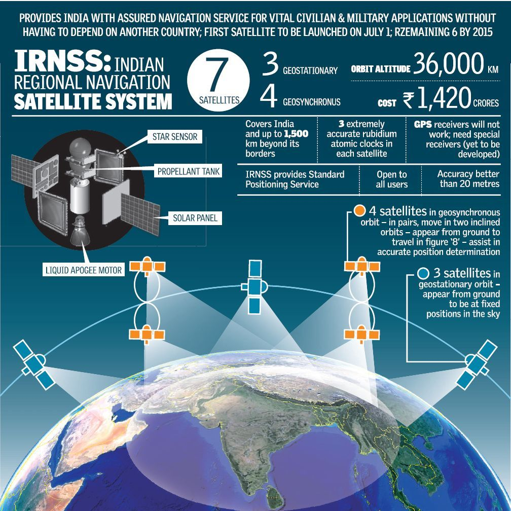
- An autonomous regional satellite navigation system,also known as Indian Regional Navigation Satellite System (IRNSS), is developed by ISRO.
- It has been designed to provide accurate position information service to users in India as well as the region extending up to 1500 km from its boundary.
- It will provide two types of services:
- Standard Positioning Service (SPS): provided to all the users.
- Restricted Service (RS) : It is an encrypted service provided only to the authorised users.
- The IRNSS System is expected to provide a position accuracy of better than 20 m in the primary service area.
- Presently, it consists of 7 active satellites located at a distance of approximately 36,000 Km.
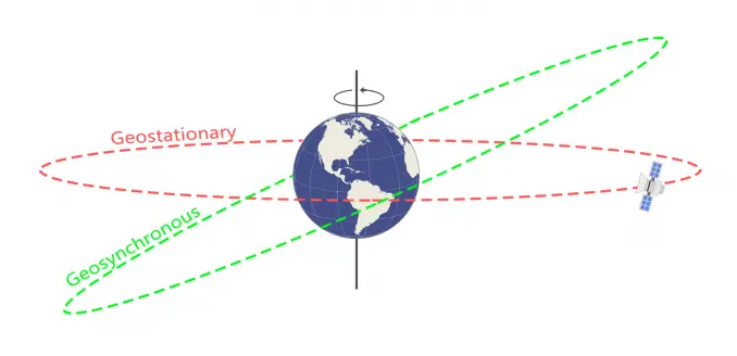
- 3 satellites are in Geostationary Orbit (GEO).
- 4 satellites are in inclined Geosynchronous Orbit (GSO).
Image Courtesy: Gis Geography |
- India became the fourth country in the world to have its independent regional navigation satellite system recognised by the International Maritime Organisation(IMO).
- The other three countries that have its navigation systems are the US, Russia and China.

Image Courtesy: Pinterest
Some applications of Navic
- Terrestrial, Aerial and Marine Navigation, Disaster Management, Vehicle tracking and fleet management, Integration with mobile phones, Precise Timing, Mapping and Geodetic data capture etc.
Significance
- Revenue generation: It will bring healthy competition between various navigation services, and potentially significant revenues for the country.
- Technological Innovation: NAVIC should also propel technological innovations and spin-offs that render India progressively less reliant on technological imports from the West and elsewhere.
- India can combine NAVIC with GAGAN—its indigenous augmentation system—to service users on differential rates depending on the navigational precision they seek.
- Interoperability: NAVIC’s interoperability with GPS can ensure the minimization of technical snags when used complementarity with existing GPS-enabled solutions.
- Net security providers: It will bolster the ability of a nation to serve as a net security provider along with its neighbours.
- The US equivalent, Global Positioning System (GPS), played a significant role in relief efforts post disasters such as the tsunami in the Indian Ocean region in 2004 and the Pakistan-India earthquake in 2005.
Other Satellite Navigation Systems
|
Satellite Navigation Systems |
Key Points |
|
Global Positioning System (GPS) |
|
|
Global Navigation Satellite System (GLONASS) |
|
|
GALILEO |
|
|
Quasi-Zenith Satellite System (QZSS) |
|
|
National Telecommunications Institute for Policy Research, Innovation and Training (NTIPRIT)
GPS Aided Geo Augmentation System (GAGAN)
|
