


Syllabus: GS1/ Geography
Context
- The United Nations has adopted a resolution to shift away from the 16th-century Mercator map of the world towards one that more accurately depicts Africa’s vast size.
Why Earth Cannot Be Accurately Shown on a Flat Map?
- Earth is an oblate spheroid, rather than a perfect sphere, because of its rotation, gravitational effects and uneven distribution of land and oceans.
- A map projection converts the three-dimensional curved surface of Earth into a two-dimensional plane, inevitably introducing some distortion.
- Every projection involves a trade-off between area, shape, distance and direction.
- Therefore, no single flat map can simultaneously preserve all geographical properties accurately.
About Mercator Projection
- Origin: The Mercator layout was introduced by the Flemish (present-day Belgium) geographer and mapmaker Gerardus Mercator in 1569 to help sailors navigate the world.
- It is a conformal, cylindrical map. This means Mercator projected the Earth’s surface as if unwrapped from a cylinder around the globe.
- In the 18th century, it became the standard map projection for navigation due to its property of representing rhumb lines as straight lines.
- The Mercator projection has a grid pattern with longitudes and latitudes at 90-degree angles.
- The longitudes (vertical lines) are evenly spaced, but the distances between the latitudes (horizontal lines) increase as one moves away from the equator towards the poles.
- The result is that Mercator projection inflates the size of lands the farther they are from the equator.
- Therefore, landmasses such as Greenland and Antarctica appear far larger than they actually are relative to landmasses near the equator.
Concern with Mercator projection
- The Mercator layout has been the world’s most widely used projection for centuries. However, it has also long been criticised for exaggerating the size of regions towards the poles relative to those closer to the equator.
- The most infamous example of these distortions is its depiction of the African continent, which appears similar to Greenland—an island 14 times smaller and about the size of the Democratic Republic of the Congo.
Evolution of Alternative Projections
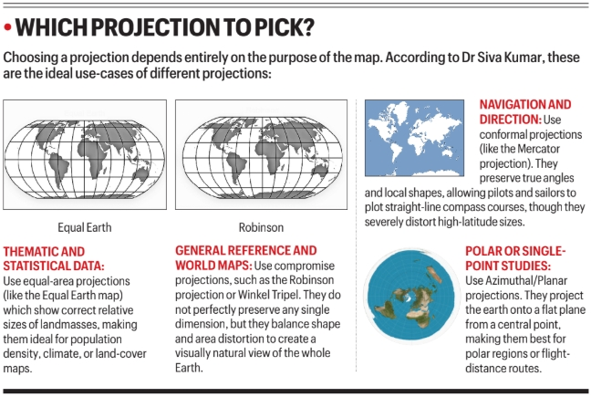
- Gall-Peters projection: It preserves area but significantly distorts shapes.
- Robinson projection: A compromise projection designed to balance distortions in area and shape.
- Winkel Tripel projection: It balances distortion in area, distance and direction and was adopted by the National Geographic Society in 1998.
- Equal Earth projection: It preserves relative area while limiting shape distortion.
The Equal Earth map
- The Equal Earth map, developed in 2018, is an equal area projection (there are others, too) that seeks to preserve the relative areas of landmasses.
- It, too, somewhat distorts shapes and distances, with meridians curving gently towards the poles
Source: IE
Previous article
News In Short 08-09-2026
