Syllabus: GS1/Geography
Context
- The Environment Impact Assessment (EIA) study carried out for the Great Nicobar Infrastructure Project (GNIP) downplays the risk of future earthquakes that could trigger tsunamis on the scale that was seen in 2004.
About
- The GNIP envisages a trans-shipment port, an international airport, township development, and a 450 Megavolt-Amperes (MVA) gas and solar-based power plant in the GNI.
- It was accorded an environment and preliminary forest clearance by the Centre.
- Concerns: Potential loss of biodiversity, tree-felling, and impact on resident tribes prompted the National Green Tribunal to order a review of the environmental aspects of the project.
- The islands were among the worst affected regions during the 2004 Indian Ocean tsunami-earthquake.
- The region falls under the highest seismological category of five and is highly prone to earthquakes, as the Indian Plate dives beneath the Burmese Microplate along the Andaman Trench in a process known as “subduction.”
Earthquake
- An earthquake is an intense shaking of Earth’s surface. The shaking is caused by movements in Earth’s outermost layer.
- The Earth is made of four basic layers: a solid crust, a hot, nearly solid mantle, a liquid outer core and a solid inner core.
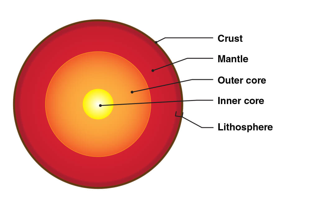
- The solid crust and top, stiff layer of the mantle make up a region called the lithosphere.
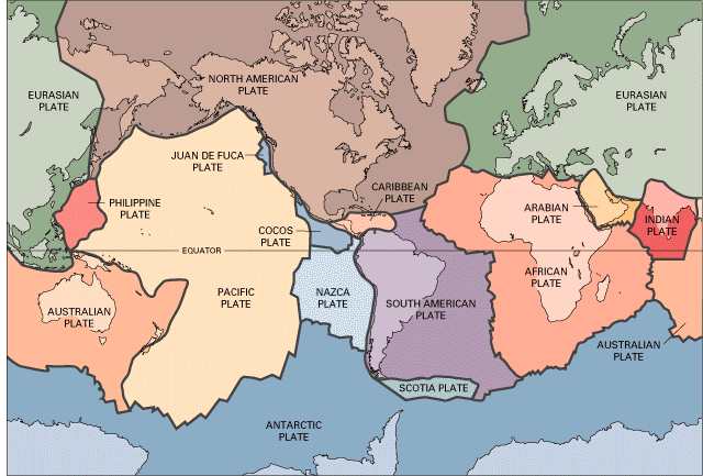
- The lithosphere is made up of tectonic plates and tectonic plates are constantly shifting as they drift around on the viscous, or slowly flowing, mantle layer below.
- This non-stop movement causes stress on Earth’s crust, when the stresses get too large, it leads to cracks called faults.
- When tectonic plates move, it also causes movements at the faults. An earthquake is the sudden movement of Earth’s crust at a fault line.
- Epicenter: The location where an earthquake begins is called the epicenter.
- An earthquake’s most intense shaking is often felt near the epicenter.
Read our detailed article on Earthquakes.
Measurement of Earthquakes
- The energy from an earthquake travels through Earth in vibrations called seismic waves.
- Scientists can measure these seismic waves on instruments called seismometers.
- Magnitude: Measured by Richter Scale ranging 0-10.
- The intensity scale, named after Mercalli, considers the visible damage caused by the event.
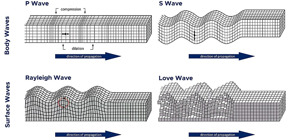
Seismic Waves
- Seismic waves are energy waves generated by an earthquake that travels through the Earth’s layers, causing ground shaking.
- They are mainly classified into two types: body waves and surface waves.
- Body Waves: These waves travel through the interior of the Earth. They are faster and arrive before surface waves during an earthquake.
- Surface waves travel along the Earth’s surface and are slower than body waves but cause the most damage due to their larger amplitude.
Types of Body Waves
- P-Waves (Primary Waves): They are the fastest seismic waves and the first to be recorded by seismographs. They move in a compressional or longitudinal manner.
- P-waves can travel through solids, liquids, and gases.
- S-Waves (Secondary Waves): They move in a transverse manner, where particles move perpendicular to the wave’s direction of propagation.
- S-waves can travel only through solids, as liquids and gases do not support shear stress.
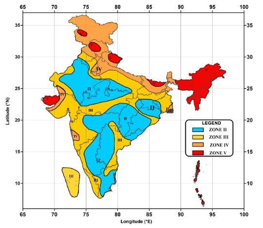
India’s Vulnerability to Earthquakes
- India is highly vulnerable to earthquakes, with 58.6% of India’s landmass is prone to moderate to very high intensity earthquakes.
- The total area is classified into four seismic zones: Zone V is seismically the most active region, while zone II is the least.
- Approximately, ~ 11% of the country falls in zone V, ~18% in zone IV, ~ 30% in zone III and remaining in zone II.
Source: TH
Previous article
News In Short-05-07-2025
Next article
Studying in Mother Tongue Instils Strong Values: CJI