
 80813-00200


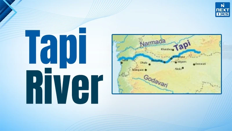
The Tapti or Tapi river is the 2nd longest west flowing peninsular river. It has a total length of about 724 kilometres and flows westward into the Gulf of Khambat in Arabian Sea. The river flows parallel to the Narmada river through a rift valley between the Satpura range and Ajanta hills. Many industrial centres are directly supported by the river such as textile and diamond industries at Surat, Gujarat. In medieval historic times, the river bank supported the Mughal port of Surat which was a centre of global trade. The Ukai dam in Gujarat is the 2nd largest reservoir which controls floods and generates hydropower. It has a total installed power capacity of about 300 MW.
Origin & Course of Tapi River
The Tapti river originates from Multai in Betul district of Madhya Pradesh. The origin of tapi river lies at an elevation of about 752 metres in the Satpura Range. The name ‘Tapi’ is derived from ‘Tapati’ who is the daughter of Sun god and reflects its mythological connection. The river flows westward through Madhya Pradesh, Jalgaon-Bhuswal plateau in Maharashtra, and through Surat plains in Gujarat. It covers a total length of about 724 kilometres which makes it the 2nd longest west flowing peninsular river after Narmada river. The Tapi drains into the Arabian Sea through the Gulf of Khambat or Cambay. The river forms an estuary near Surat in Gujarat. The tapi river flows through a broad trough between Satpura and Ajanta mountain ranges.
Tapi River Tributaries
| S.No. | Left Bank Tributaries | Right Bank Tributaries |
|---|---|---|
| 1 | Purna (largest left bank tributary) | Gomai |
| 2 | Girna | Aner (largest right bank tributary) |
| 3 | Panjhara (Panzara) | Arunavati |
| 4 | Bori | Vaki |
| 5 | Waghur | - |
| 6 | Amravati | - |
| 7 | Buray | - |
| 8 | Nesu | - |
| 9 | Mona | - |
| 10 | Sipna | - |
Historical Importance of Tapti River
The Tapi river has been a great cultural and economic corridor since ancient times. The river lies near the Arabian sea and the port of Surat in Gujarat which makes it an important route for maritime trade with west Asia, East Africa, and Europe.
In medieval India, Surat lies on the south bank of river Tapi and was the principal port for pilgrims and commerce during the Mughal empire. The river estuary facilitated the movement of ships and goods which provided a linkage to the Deccan and central India with global trade networks.
Many military battles were fought in the region of Tapi river such as the raids by Chhatrapati Shivaji Maharaj on Surat in 1664 and 1670. It targeted the Mughal ports to hamper the imperial revenue and put forward the assertion of the Maratha strength. Historically, the Tapi river basin was useful for agriculture, settlements and pilgrimage routes. Many tribal people and communities took shelter in the forests and hills in the tapi region. Therefore, Tapi river included trade, politics, and culture in western and central India.
Important Dams on Tapi River
| S.No. | Dam | State | Key Features |
|---|---|---|---|
| 1 | Ukai Dam | Gujarat |
|
| 2 | Kakrapar Barrage | Gujarat |
|
| 3 | Girna Dam | Maharashtra |
|
| 4 | Other minor projects | Maharashtra & Madhya Pradesh |
|
FAQs about Tapti River
Where is Tapi river located?
Tapi river is located in the central part of India. It flows through Madhya Pradesh, Maharashtra, Gujarat and drains into the Arabian Sea.
Where does Tapi river originate?
The Tapi river originates from Multai in the satpura range in Betul district of Madhya Pradesh.
What are the tributaries of Tapi river?
The major tributaries of Tapi river are Purna, Girna, Panjhara, Waghur, Gomai, Aner, and Arunavati.
Tapi river is in which state?
The tapi river flows through the states of Madhya Pradesh, Maharashtra, Gujarat and drains into the Arabian sea.
What is the length of Tapi river?
The length of the tapi river is about 724 kilometres. It is the 2nd longest west flowing peninsular river after River Narmada.
