
 80813-00200


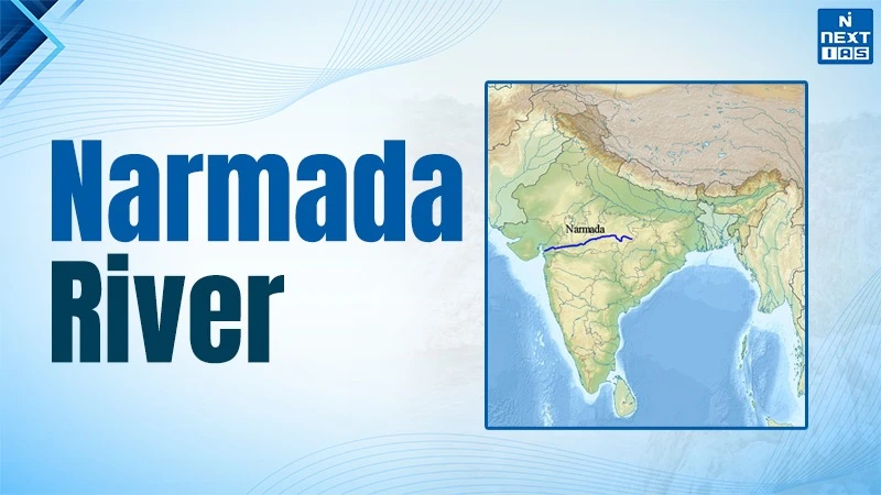
Narmada river is the longest west flowing river and overall 5th longest river of India. It originates at the Amarkantak Plateau and flows about 1,312 kilometres in the Arabian Sea. The river flows in the west through a rift valley between Vindhyan and Satpura mountain ranges. It carves a 100 foot deep marble rocks gorge at Bhedaghat in Jabalpur and cascades into Dhuandhar waterfalls. The Narmada river forms an estuary rather than a delta due to the high speed of the river.
Origin & Course of Narmada River
Narmada River originates from Narmada kund which is a sacred spring at Amarkantak in the Anuppur district in Maikal Hills. It lies near the border of Madhya Pradesh and Chattisgarh at an elevation of about 1,057 metres in the east part of Madhya Pradesh. It is an important hindu pilgrimage site. The Narmada river is regarded as one of the 7 holy rivers of India and is known as 'Reva' in ancient texts. Its origin in the dense forest of Maikal range makes it a perennial river.
The Narmada river flows in the west through a rift valley between the Vindhyan and Satpura ranges. It is the longest west flowing peninsular river in India and travels about 1,312 kms through Madhya Pradesh, Maharashtra and Gujarat. The river forms an estuary and then drains into the Gulf of Khambhat or Cambay in the Arabian Sea. The course of the river comprises gorges, waterfalls such as Dhuandhar near Jabalpur and many important dams. The river does not form delta and rather forms estuaries because of its fast flow and hard bedrock.
Narmada River Tributaries
| S.No. | Left Bank Tributaries | Right Bank Tributaries |
|---|---|---|
| 1 | Burhner | Hiran |
| 2 | Banjar | Tendoni (Tindoni) |
| 3 | Sher | Barna |
| 4 | Shakkar | Kolar |
| 5 | Dudhi | Man |
| 6 | Tawa (largest) | Uri |
| 7 | Ganjal | Hatni |
| 8 | Chhota Tawa | Orsang |
| 9 | Kundi | Karjan |
| 10 | Goi | - |
| 11 | Karjan | - |
Historical Importance of Narmada River System
The Narmada river is among one of the 7 holy rivers and is often mentioned in the Puranas, Mahabharata, and Ramayana. It is believed that merely a sight or दर्शन of Narmada river purifies the soul. The Narmada Parikrama(परिक्रमा) is an ancient pilgrimage practice. People come from hundreds of kilometres of distance to circum-ambulate on foot along both banks of the river. From a historical perspective, the Narmada valley formed a natural boundary between Aryavarta or north and Dakshinapatha or south. These boundaries influenced the political and cultural divisions in India. The river facilitated trade and routes between the central region and western ports in India. As a result, it shaped the regional economies and settlement patterns.
Sardar Sarovar Dam
The Sardar Sarovar is a concrete gravity dam on the Narmada river near kevadia in Gujarat. The length of the dam is about 1,210 metres and height is 163 metres from its deep foundation. The reservoir of the dam has a storage capacity of about 334 tmc ft and supports irrigation, drinking water, and power generation. The total power installed capacity of the dam is 1,450 MW. The Narmada Valley Project is an important river development project such as building small, medium and large dams on Narmada river.
Narmada Canal
The Narmada or Sardar Sarovar is an important irrigation canal of the Sardar Sarovar Project. It originates from the canal head works of the dam in Gujarat. It is the longest lined irrigation canal in the world. The main canal runs about 458 kms to the Gujarat-Rajasthan border. The Narmada canal irrigates about 18.45 lakh hectares in 15 districts of Gujarat. It also provides drinking water supply to thousands of villages and many cities. The network of narmada canal extends to Rajasthan where it supports the drought-prone regions of Kutch and Saurashtra via branch canals and supply pipelines.
Indira Sagar Dam
It is an important multipurpose project on the Narmada river near Punasa in khandwa district in Madhya Pradesh. It is a concrete gravity dam which creates a large reservoir which provides irrigation, drinking water, and hydropower. The total installed power capacity is 1,000 MW. Indira Sagar dam is a part of the Narmada Valley Development Plan which helps in regulating the flow for downstream projects such as Sardar Sarovar and Omkareshwar. The reservoir is one of the largest by volume in India and assures water security in the western part of Madhya Pradesh.
FAQS about Naramada
Where is Narmada River located?
The Narmada river is located in the central part of India.
What is the length of the Narmada River?
The Narmada river is about 1,312 kilometres long which makes it the 5th longest river in India. It is the longest west flowing river in India.
Narmada river flows through which states?
The Narmada river flows majorly through Madhya Pradesh, Maharashtra, Gujarat and finally drains in the Arabian Sea.
Which river system Narmada river is part of?
The Narmada river is a west flowing peninsular river. It has its own independent narmada river basin.
