
 80813-00200



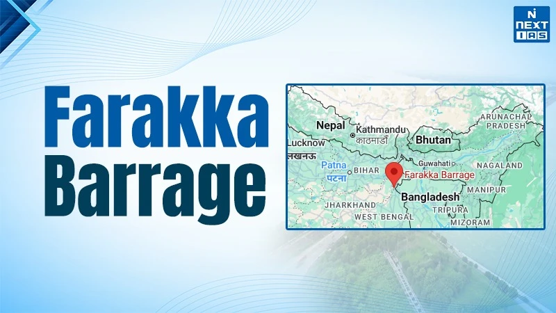
The Farakka Barrage is one of the important water structures built across the Ganga River located in Murshidabad district in West Bengal state. Constructed in 1975, this barrage was mainly used to divert water to the Bhagirathi-Hooghly river system in order to minimize sedimentation and to keep the Kolkata Port navigable. This barrage is about 2,245 metres long with 109 bays containing 112 main gates and its 38.38-km long canal can discharge water up to 40,000 cubic feet per second.
In addition to that, this project helps in inland navigation, water supply and regional connectivity due to its road-cum-rail bridge. As this barrage is located close to the borders of Bangladesh, it is very important in India-Bangladesh water sharing relationship governed by the Ganga Water Treaty 1996.
About the Farakka Barrage
- Location: On the Ganges River, Murshidabad district, West Bengal
- Construction: Construction Started in 1962, and it completed in the 1970s, while commissioned in 1975.
- Length of the Bridge: Approximately 2,245 metres long (around 2.24 kilometres).
-
Purpose of the Project:
- To reduce heavy siltation due to river flow and reviving the Kolkata port,
- Increasing the availability of water in the Hooghly River (a major distributary of the Ganga rivers).
- River Division: From here ganga river divides into two streams i.e. bhagirathi becomes Hooghly flowing through West Bengal and the Padma flowing in bangladesh towards bay of bengal.
-
The barrage along with its ancillary structures comprises of the
following three main structures:
- Main Barrage: The main barrage on the river Ganga at Farakka regulates the flow of water from India to Bangladesh. It is 2245 m long and has 112 gates. It was designed for maximum discharge of 27 lakh cusecs.
- Head Regulator: It is constructed at the origin of the feeder canal to regulate the inflow of water into the river Bhagirathi-Hooghly through a feeder canal from the river Ganga.
- Jangipur Barrage: Jangipur barrage was constructed at the off take point of the Bhagirathi-Hooghly to regulate flow of water from the Ganga and vice versa. A 38.38 km long feeder canal connects Bhagirathi-Hooghly and Ganga.
- There is a pair of railway tracks and pre-reinforced concrete road bridge on the downside running parallel to the main barrage. They serve as the direct surface communication link between the south and north in West Bengal and thereafter the north-eastern part of India.
- The operation and maintenance of the Farakka Barrage Project (FBP) is entrusted to the Farakka Barrage Authority (FBA) under the Ministry of Water Resources (MoWR), Government of India (GOI).
Do You Know?
- The rail-cum-road bridge built across the river Ganga at Farakka establishes a direct road and rail communication link to the North-Eastern Region with the rest of the country.
- The Hoogly-Bhagirathi river system, the Feeder Canal and the Navigation Lock at Farakka form part of the Haldia-Allahabad Inland Waterway (National Waterway No:1).
- The Feeder Canal also supplies water to the 2100 MW Farakka Super Thermal Power Project (FSTPP) of NTPC Ltd. at Farakka.
Historical Background of Farakka Barrage
- Concerns about increasing siltation in the Hooghly River had been expressed since the years of the British Raj.
- The Kolkata port has been a major trading center since the colonial period, with its growth and operation closely tied to the hooghly river.
- With time, the main course of the Ganges shifted eastward, reducing the water flow in the distributary and leading to silt accumulation.
- After independence the government of India, recognized the importance of its national interest, and planned the barrage.
- In 1951 the project was formally proposed by the govt, with the objective to divert a portion of the Ganges water through a feeder canal into the hooghly river to maintain the navigability of the kolkata port.
Construction and Technical Features
- The construction of the Farakka Barrage finally began in 1961 and came into operation from 1975.
- The length of the barrage is approximately 2.24 kilometers with 109 gates.
- A 38 KM long feeder canal was also constructed to divert the water of the Ganga river into the Hooghly distributary.
- Technically, the Farakka barrage project was one of the largest river control structures. It attempted to simultaneously address river flow control with silt management and navigation support.
India-Bangladesh Water Dispute and the 1996 Water Treaty
- The international aspect of the barrage makes the project the most sensitive aspect. Downstream of the barrage, the Ganges enters Bangladesh, where it is known as the Padma River.
- During the dry season, India's diversion of a portion of the Ganges water towards the Hooghly led to reduced water flow in Bangladesh.
- Bangladesh (then East Pakistan) objected to the project from the 1960s onwards. The dispute intensified with the commissioning of the barrage in 1975.
- This led to temporary agreements, joint commissions and diplomatic negotiations between the two countries India and Bangladesh (the then east Pakistan).
- Finally, in 1996, the India-Bangladesh Ganges Water Treaty was signed, establishing a formula for sharing Ganges water at Farakka for a period of 30 years.
- This treaty is considered a significant example of bilateral water cooperation, although its implementation in practice has also been questioned.
Functions of Farakka Barrage Project
- Ensuring diversion of designated Ganga waters to Bhagirathi-Hoogly river system for improvement and preservation of Kolkata Port.
- Improvement in Navigation System in National Waterway No. 1 (within the reach of Farakka to Kolkata Port at Haldia) operating between Haldia and Allahabad.
- Reduction in salinity of water and thus improvement in availability of potable water to Kolkata and surrounding areas.
- Surface communication links the North-Eastern Region of India with the rest of the country including Bhutan and Nepal through Rail cum Road Bridge over Farakka Barrage.
- Release of water to Bangladesh as per Indo-Bangladesh Treaty-1996 for sharing of Ganga waters during lean periods.
- Protecting countryside dwellers, their land, public property including roads, bridges by checking the erosion along the river Ganga-Padma in districts Malda & Murshidabad.
- Ensuring water supply for use of Thermal Power Plant operated by NTPC Ltd. at Farakka (2100 MW) and by West Bengal State Power Distribution Company at Sagardighi (600 MW).
Impact of the Barrage
Social and Economic Impacts
- Though the project of Farakka barrage eased some of the problems of the Kolkata port, it simultaneously led to large scale displacement in the surrounding region.
- Thousands of families were forced to leave their land due to the project and the rehabilitation process was also slow in many cases and inadequate too.
- Communities dependent on the river based economic activities like fisheries, agriculture and transportation faced long term uncertainty.
Environmental Impacts
- The region faced extremely complex environmental consequences due to the barrage.
- The obstruction of the natural flow of the river led to increased siltation, which resulted in flooding upstream and reducing water levels downstream.
- Complaints arose regarding the drying up of riverbeds during the dry season leading to soil salinity and decreasing agricultural productivity.
- The nearby districts Malda and Murshidabad of west Bengal faced serious problems of erosion etc.
- Aquatic biodiversity like fish species etc were adversely affected due to natural migration routes.
Contemporary Challenges
- Critics argue that the barrage is an example of imposing a technical solution on the political and ecological complexities.
- New hydrologic variables due to climate change such as altered monsoon patterns, intense rainfall and himalayan glacier retreat, critically affect the flow of the river.
- The 2022 CWPRS study found that the practice of skewed gate operation schedule, causes severe stress on the infrastructure.
- The complexity and rising cost of mitigating its own unintended geomorphological consequences, leading to serious operational deficiencies, demanded a strategic re-evaluation of the 1996 treaty.
- The barrage severely disrupted the river's natural flow, causing excessive siltation, upstream flooding, reduced downstream water levels, erosion in Malda and Murshidabad districts, and significant damage to aquatic biodiversity due to blocked fish migration routes.
Way Forward
- Promoting riverbank stabilization, afforestation, wetland restoration and fish ladders to revive biodiversity and reduce ecological erosion.
- There is a need to approach involving hydrology, ecology, navigation, irrigation and flood control rather than a project specific engineering outlook.
- There is a growing recognition of the need for a holistic river basin management approach such as data sharing and enhanced cooperation between India and Bangladesh, rather than relying solely on barrage based solutions.
- The focus should be on communities dependent on the river based economic activities like fisheries, agriculture and transportation.
- In future policy such projects should not only be treated as a water resource but also a vibrant ecosystem.
FAQs about Farakka Barrage
Where is the Farakka Barrage located?
The Farakka Barrage is Located on the ganga river in west Bengal.
What is the length of the Farakka Barrage?
The length of the Farakka Barrage is approximately 2.24 kilometers.
When was the construction of the Farakka Barrage complete?
The construction of The Farakka Barrage started in 1961 and completed in1975.
