

Syllabus: GS1/ Geography
In Context
- Torrential monsoon rains continued to affect Maharashtra triggering landslides and structural collapses that disrupted road and connectivity across the state.
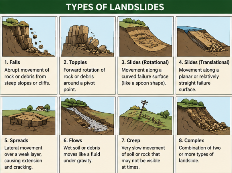
What is a Land Slide?
- A landslide is a mass movement of material, such as rock, earth or debris, down a slope. They can happen suddenly or more slowly over long periods of time.
- When the force of gravity acting on a slope exceeds the resisting forces of a slope, the slope will fail and a landslide occurs. External factors can lead to landslides happening, including:
- heavy rainfall leading to saturation of the ground
- erosion of the base of a slope
- changes to the material’s strength through weathering
Key Facts on Landslides in India
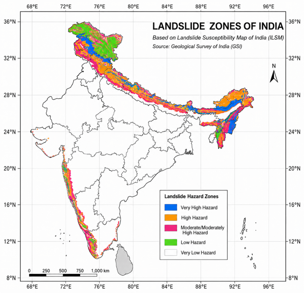
- According to the India Landslide Susceptibility Map (ILSM), about 13.17% of India’s geographical area is prone to landslides, while 4.75% falls under the ‘very high susceptibility’ category.
- The Himalayas, Northeastern States, and Western Ghats are the country’s major landslide hotspots.
- Sikkim has the highest share of landslide-prone area (57.6%), whereas Kerala has nearly 14% of its area in the ‘very high susceptibility’ category despite being outside the Himalayan region.
- India accounts for around 8% of global deaths caused by landslides.
- The agency for mapping landslide-prone areas and hazard assessment is the Geological Survey of India (GSI).
Major Causes of Landslides
- There are rarely any single causes; they are usually a combination of natural vulnerability and human interference.
- In the Himalayan regions there are factors like presence of young and tectonically active mountains, hydropower projects, road widening, tunnelling and intense rainfall and cloud bursts.
- In the Western ghats, although geologically older and more stable than the Himalayas but heavy monsoon rainfall, mining, quarrying, tourism, and unplanned construction increase the landslide risk.
Steps Taken to Reduce Landslide Risk
- National Landslide Forecasting Centre (NLFC): It was set up by the GSI in Kolkata to improve landslide forecasting and early warnings.
- Bhusanket Portal & Bhooskhalan App: These apps provide real-time landslide forecasts and reporting of landslide events.
- NDMA Guidelines: The National Disaster Management Authority (NDMA) has issued comprehensive guidelines for managing landslides and snow avalanches.
- National Landslide Risk Management Strategy: Focuses on hazard mapping, monitoring, early warning systems, awareness, capacity building, and slope stabilization.
- Sendai Framework (2015–2030): India follows this global framework for disaster risk reduction and building resilience.
What NDMA Says?
- The National Disaster Management Authority has issued a clear road map:
- Prepare the Landslip Hazard Zonation (LHZ) maps so that we know exactly which areas need attention.
- GSI to maintain a National Landslip Database to monitor trends and risk over time.
- Retaining walls, rock bolting, wire mesh, and vegetation cover can all be used to physically stabilise slopes.
- Fix drainage so water does not collect and seep into the slope.
Way Forward
- Notify and implement the Eco-Sensitive Area (ESA) framework in the Western Ghats to regulate mining, quarrying, and large infrastructure projects.
- Make land-use zoning based on detailed Landslide Hazard Zonation (LHZ) maps mandatory in hilly regions.
- Deploy AI-enabled sensors, early warning systems into vulnerable areas so people receive alerts on time.
- Employ drones, LiDAR and satellite imagery to keep a constant eye on vulnerable slopes.
- Rely on afforestation and other nature-based solutions. In many cases, they are cheaper and more sustainable than concrete fixes.
Source: TH
Previous article
News In Short 04-07-2026
