Syllabus: GS3/ Science and Technology
Context
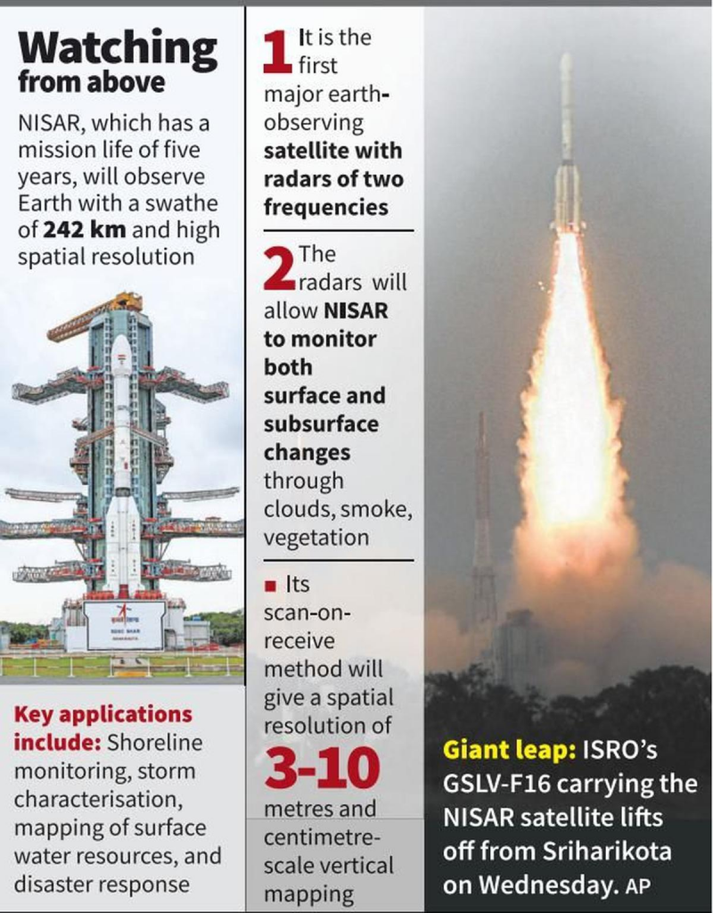
- The NASA-ISRO Synthetic Aperture Radar (NISAR) satellite was launched from the Satish Dhawan Space Centre at Sriharikota in Andhra Pradesh.
NISAR Satellite
- NISAR is an Earth-observation satellite that stands for NASA-ISRO Synthetic Aperture Radar.
- It is Jointly developed by the National Aeronautics and Space Administration (NASA) and the Indian Space Research Organisation under a partnership agreement signed in 2014.
- It will be launched into a polar Sun-synchronous dawn-dusk orbit at 747 km altitude and an inclination of 98.4º.
- NISAR is the first satellite mission to collect radar data in two microwave bandwidth regions, called the L-band and the S-band.
- The S-band payload has been made by the ISRO and the L-band payload by the U.S.
Monitoring of Earth Surface
- The NISAR system comprises a dual frequency, fully polarimetric radar, with an imaging swath greater than 150 miles (240 km).
- This design permits complete global coverage every 12-days, allowing researchers to create time-series interferometric imagery and systematically map the changing surface of Earth.
- It can monitor various aspects in very high resolution.
- After a 90-day commissioning period, the mission will conduct a minimum of three full years of science operations with the L-band radar to satisfy NASA’s requirements,
- ISRO requires five years of operations with the S-band radar.
Source: TH
Previous article
Chile’s Coastal Erosion