


Syllabus: GS3/ Science and Technology
Context
- In order to restore the functioning of India’s indigenous satellite navigation system (NavIC), ISRO is launching NVS-03 satellite.
Navigation with Indian Constellation (NavIC)
- Established by Indian Space Research Organisation (ISRO), NavIC is India’s autonomous regional navigation satellite system, designed to fulfill both civilian and military navigational needs. It was launched in 2013.
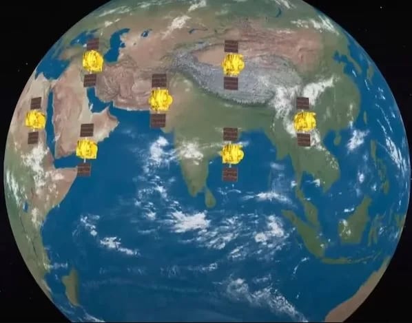
- NavIC was erstwhile known as the Indian Regional Navigation Satellite System (IRNSS).
- It provides precise Position, Velocity, and Timing (PVT) services within India and extends up to 1,500 km beyond the country’s borders, forming its primary service area.
- Its development began following the 1999 Kargil War, when India reportedly faced restrictions on access to GPS information from the United States
- NavIC is designed with a constellation of 7 satellites and a network of ground stations operating 24 x 7.
- Three satellites of the constellation are placed in geostationary orbit and four satellites are placed in inclined geosynchronous orbit.
- NavIC offers two services:Standard Position Service (SPS) for civilian users and Restricted Service (RS) for strategic users.
- It provides location accuracy better than 20 meters and timing accuracy better than 40 nanoseconds across the core service area.
- Navigation frequencies: The first-generation satellites use L5 and S-band frequencies.
NVS Series
- These are five second-generation NavIC satellites — NVS-01 to NVS-05 and are planned to enhance the existing constellation.
- These satellites incorporate L1 band communication, which broadens NavIC’s compatibility and usability for diverse applications.
- NVS-01, the first of the second-generation satellites, was launched in 2023.
- For the first time, an indigenous atomic clock was flown in NVS-01.
- NVS-02 was launched in January 2025.
- The second-generation NVS satellites carry at least one indigenously developed rubidium atomic clock.
- Developed by ISRO’s Space Applications Centre, they are intended to replace the imported rubidium clocks that were used in the first generation of IRNSS satellites.
About Atomic Clock
- An Atomic Clock is a highly precise time-keeping device that measures time based on the natural vibration frequency of atoms, usually cesium or rubidium atoms.
- It is considered the most accurate time-keeping technology, capable of maintaining accuracy to nanoseconds (billionths of a second).
- Working Principle:
- Atoms vibrate at extremely stable and predictable frequencies when they change energy states.
- The atomic clock measures this frequency and converts it into standard time signals.
Why is NavIC currently not functioning as intended?
- Failure of Atomic Clocks: Several first-generation satellites experienced failures of their onboard clocks, reducing the number of satellites available for positioning services.
- In March 2026, the last functioning atomic clock aboard IRNSS-1F also stopped working after the satellite completed its designed mission life of 10 years.
- Failure of NVS-02: NVS-02 was successfully placed in Geosynchronous Transfer Orbit (GTO), but a technical malfunction prevented its propulsion system from completing the required orbit-raising manoeuvre.
- Insufficient Operational Satellites: As of July 2026, only three satellites (IRNSS-1B, IRNSS-1I and NVS-01) were providing Positioning, Navigation and Timing (PNT) services.
- At least four operational satellites are required for basic standalone positioning services. Consequently, NavIC’s standalone positioning capability is currently unavailable, although its timing service remains functional.
How does NVS-03 strengthen India’s navigation capabilities?
- Restoration of Positioning Services: Its successful commissioning would increase the number of operational satellites to the minimum threshold of four required for basic standalone positioning services.
- Improved Compatibility: The L1 frequency will facilitate the adoption of NavIC in consumer electronic devices.
Other Satellite Navigation Systems
- GPS: Developed and operated by the United States, it uses a constellation of satellites primarily in Medium Earth Orbit (MEO).
- GLONASS: Russia’s global navigation satellite system.
- Galileo: The European Union’s independent global navigation system.
- BeiDou: China’s global navigation system, using a combination of Medium Earth Orbit, Geostationary Orbit and Geosynchronous Orbit satellites.
- QZSS: Japan’s regional satellite navigation system designed to complement GPS over Japan and the Asia-Oceania region.
Source: TH
Previous article
New Fortified Potato Variety
Next article
News In Brief 30-10-2026
