Syllabus: GS2/Government Policies and Interventions; GS3/Infrastructure
Context
- The Great Nicobar Island has emerged as a focal point for India’s strategic and developmental ambitions, as the government pushes forward with a massive infrastructure overhaul.
About the Great Nicobar Project
- It was piloted by NITI Aayog, has an estimated cost of ₹72,000 crore, aims to balance development with environmental preservation.
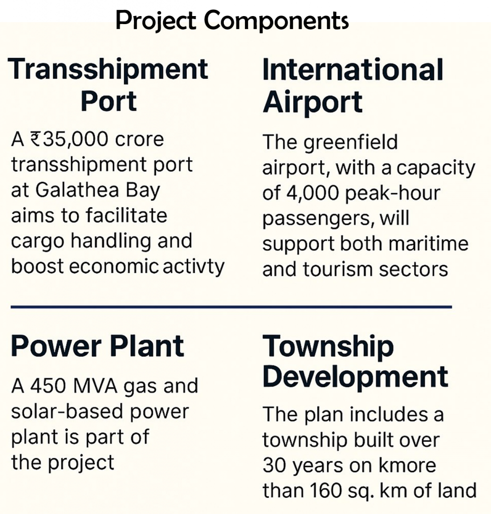
- It encompasses various components, including a transshipment port, an international airport, a power plant, and township development.
- The goal is to tap into the largely unexplored potential of the island while preserving its natural ecosystem and rich biodiversity.
Strategic Significance of Great Nicobar Island
- Geopolitical Location: It is a part of the Andaman and Nicobar archipelago, located at the southernmost tip of India in the Bay of Bengal.
- It is near the Malacca Strait, a key maritime route that enhances India’s maritime security and trade capabilities, and commanding position in the Indo-Pacific.
- Sabang in Indonesia is 90 nautical miles southeast of Indira Point (on Great Nicobar island), and Coco Island in Myanmar is 18 nautical miles from the northernmost tip of the Andamans.
- Military and Civil Infrastructure: The ₹72,000 crore development plan includes an International Container Transshipment Terminal, a dual-use airport, military logistics bases, and surveillance infrastructure.
- Regional Influence: The project aligns with India’s Act East Policy and Security and Growth for All in the Region (SAGAR) doctrine, countering China’s growing naval presence in the Bay of Bengal.
- Infrastructure Overhaul and Military Preparedness: It includes revamped airfields and jetties; modern logistics and storage hubs; and establishment of a military base and surveillance network.
- A particular focus is on Great Nicobar Island, where the project entails an International Container Transshipment Terminal (ICTT); a greenfield international airport; a new township; and solar-based power plants.
Key Concerns
- Ecological Sensitivity and Indigenous Concerns: Potential harm to indigenous communities, especially the Shompen (a PVTG), a largely uncontacted tribe;
- The island hosts endangered species like the Nicobar megapode and leatherback turtles. Coral reefs and tropical rainforests are at risk due to deforestation and coastal development;
- Risk to endangered species, including the Nicobar megapode and leatherback turtles;
- Transparency Deficit: The government has invoked national security to withhold environmental reports and deny RTI requests.
- Questions raised in the Rajya Sabha were deflected under the pretext of sub judice status, undermining legislative accountability.
- Activists and experts argue that strategic development must not override democratic norms and ecological safeguards.
- Legal Red Flags: The National Green Tribunal ordered a review of environmental clearances, but the High-Powered Committee’s findings remain classified.
Way Forward
- Disclose Key Reports: Make the High Powered Committee (HPC) findings public, with redactions only where national security is genuinely at stake.
- Engage Stakeholders: Institutionalize consultations with tribal councils, environmental experts, and civil society.
- Strengthen Oversight: Empower parliamentary committees and independent bodies to monitor compliance and ecological impact.
| Andaman and Nicobar Islands – Location: The islands are located 1,300 km southeast of the Indian mainland in the Bay of Bengal. 1. It extends from 6° 45′ N to 13° 41′ N and from 92° 12′ E to 93° 57′ E. – This archipelago is composed of more than 500 big and small islands, which are divided into two distinct groups of islands – The Andaman Islands and the Nicobar Islands. 1. ‘Ten Degree Channel’ separates the Andaman Islands in the north from the Nicobar Islands in the south. Andaman Islands – These are divided into three major sub-groups – North Andaman, Middle Andaman, and South Andaman. – Port Blair, the capital city of the Andaman & Nicobar Islands is located in South Andaman.  Nicobar Islands – These islands are divided into three major sub-groups – Northern Group, Central Group, and Southern Group. 1. The Great Nicobar is the largest and the southernmost island in the group located in the Southern Group. 2. India’s southernmost point ‘Indira Point’ is located at the southern tip of the Great Nicobar. Other Features – Most of these islands have a volcanic base and are made of tertiary sandstone, limestone, and shale. 1. The Barren and Narcondam islands, north of Port Blair, are volcanic islands. 2. Some of the islands are fringed with coral reefs. – Saddle Peak (737 m) in North Andaman is the highest peak in the Andaman and Nicobar Islands. – The names of the following three islands were changed in 2018: 1. Ross Island – renamed as Netaji Subhash Chandra Bose Dweep 2. Neil Island – renamed as Shaheed Dweep 3. Havelock Island – renamed as Swaraj Dweep Particularly Vulnerable Tribal Groups (PVTGs) – Great Andamanese of Strait Island; – Onges of Little Andaman; – Jarawas of South and Middle Andaman; – Sentinelese of Sentinel Islands; – Shompens of Great Nicobar; |
| Daily Mains Practice Question [Q] To what extent do the strategic benefits of infrastructure development in Great Nicobar Island justify the concerns over environmental degradation and lack of governmental transparency? |
Previous article
Rising Seas, Shifting Lives, and a Test of Democratic Values